


-

Yellow-Band Diseases
Andrew Bruckner and Bernhard Riegl
Coral disease is quickly becoming a crisis to the health and management of the world’s coral reefs. There is a great interest from many in preserving coral reefs. Unfortunately, the field of epizootiology is disorganized and lacks a standard vocabulary, methods, and diagnostic techniques, and tropical marine scientists are poorly trained in wildlife pathology, veterinary medicine, and epidemiology. Diseases of Coral will help to rectify this situation.
-

Disentangling Habitat Concepts for Demersal Marine Fish Management
Sophie A. M. Elliott, Rosanna Milligan, Michael R. Heath, William R. Turrell, and David M. Bailey
Fishing and other anthropogenic impacts have led to declines in many sh stocks and modication of the seabed. As a result, efforts to restore marine ecosystems have become increasingly focused on spatially explicit management methods to protect sh and the habitats they require for survival. This has led to a proliferation of investigations trying to map ‘habitats’ vulnerable to anthropogenic impacts and identify sh resource requirements to meet conservation and management needs. A wide range of habitat-related concepts, with different uses and understandings of the word ‘habitat’ itself has arisen as a consequence. Inconsistencies in terminology can cause confusion between studies, making it difcult to investigate and understand the ecology of sh and the factors that affect their survival. Ultimately, the inability to discern the relationships between sh and their environment clearly can hinder conservation and management measures for sh populations. This review identies and addresses the present ambiguity surrounding denitions of habitat and habitatrelated concepts currently used in spatial management of demersal marine sh populations. The role of spatial and temporal scales is considered, in addition to examples of how to assess sh habitat for conservation and management purposes.
-

Open Ocean Deep Sea
Jeroen Ingels, Malcolm Clark, Michael Vecchione, Jose A. A. Perez, Lisa A. Levin, Imants G. Priede, Tracey Sutton, Ashley Rowden, C. R. Smith, Moriaki Yasuhara, Andrew K. Sweetman, Thomas Soltwedel, R. S. Santos, Bhavani Narayanaswamy, Henry A. Ruhl, Katsunori Fujikura, Linda Amaral-Zettler, Daniel Jones, Andrew Gates, P. V. R. Snelgrove, Patricio Bernal, and Saskia van Gaever
The deep sea comprises the seafloor, water column and biota therein below aspecified depth contour. There are differences in views among experts and agencies regarding the appropriate depth to delineate the “deep sea”. This chapter uses a 200 metre depth contour as a starting point, so that the “deep sea” represents 63 per cent of the Earth’s surface area and about 98.5 per cent of Earth’s habitat volume (96.5 per cent of which is pelagic). However, much of the information presented in this chapter focuses on biodiversity of waters substantially deeper than 200 m. Many of the other regional divisions of Chapter 36 include treatments of shelf and slope biodiversity in continental-shelf and slope areas deeper than 200m. Moreover Chapters 42 and 45 on coldwater corals and vents and seeps, respectively, and 51 on canyons, seamounts and other specialized morphological habitat types address aspects of areas in greater detail. The estimates of global biodiversity of the deep sea in this chapter do include all biodiversity in waters and the seafloor below 200 m. However, in the other sections of this chapter redundancy with the other regional chapters is avoided, so that biodiversity of shelf, slope, reef, vents, and specialized habitats is assessed in the respective regional or thematic chapters.
AB - The deep sea comprises the seafloor, water column and biota therein below aspecified depth contour. There are differences in views among experts and agencies regarding the appropriate depth to delineate the “deep sea”. This chapter uses a 200 metre depth contour as a starting point, so that the “deep sea” represents 63 per cent of the Earth’s surface area and about 98.5 per cent of Earth’s habitat volume (96.5 per cent of which is pelagic). However, much of the information presented in this chapter focuses on biodiversity of waters substantially deeper than 200 m. Many of the other regional divisions of Chapter 36 include treatments of shelf and slope biodiversity in continental-shelf and slope areas deeper than 200m. Moreover Chapters 42 and 45 on coldwater corals and vents and seeps, respectively, and 51 on canyons, seamounts and other specialized morphological habitat types address aspects of areas in greater detail. The estimates of global biodiversity of the deep sea in this chapter do include all biodiversity in waters and the seafloor below 200 m. However, in the other sections of this chapter redundancy with the other regional chapters is avoided, so that biodiversity of shelf, slope, reef, vents, and specialized habitats is assessed in the respective regional or thematic chapters.
-

Cyanobacterial Associated Colored Band Diseases of the Atlantic/Caribbean
Laurie L. Richardson, Aaron W. Miller, Patricia Blackwelder, and Husain Al-Sayegh
Coral disease is quickly becoming a crisis to the health and management of the world’s coral reefs. There is a great interest from many in preserving coral reefs. Unfortunately, the field of epizootiology is disorganized and lacks a standard vocabulary, methods, and diagnostic techniques, and tropical marine scientists are poorly trained in wildlife pathology, veterinary medicine, and epidemiology. Diseases of Coral will help to rectify this situation.
-

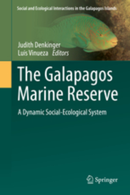
Coral Research in the Galapagos Islands, Ecuador
Joshua Feingold and Peter W. Glynn
This chapter summarizes the scientific knowledge of scleractinian corals in the Galapagos Archipelago. A general introduction to coral biology is followed by a brief history of coral research in the islands. Subsequent sections discuss responses of corals to broad-scale impacts, anthropogenic stress on Galapagos corals, and recommendations for management of this important resource. Following an initial period (1835-1960s) of cataloging the species present in the Galapagos Islands, research on coral ecology was initiated by Wellington in the 1970s. Glynn and Wellington more thoroughly examined the surprising abundance and distribution of corals and reef frameworks in the 1980s. Glynn and other workers then documented mass mortalities of corals due to the 1982-1983 ENSO disturbance. Subsequent research focused upon this natural phenomenon and its effect on coral distribution, ecology, and physiology. Most recently, resilience and recovery of coral populations were reported. Compared to most other regions, there is little anthropogenic impact to corals in the Galapagos Islands. However, climate change and ocean acidification have effects, and there is evidence of impacts associated with fisheries and tourism. Recommendations for management decisions conclude this chapter.
-

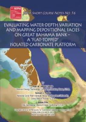
Evaluating Water-Depth Variation and Mapping Depositional Facies on the Great Bahama Bank - a "Flat-Topped" Isolated Carbonate Platform
Paul Mitch Harris, James Ellis, and Samuel J. Purkis
Great Bahama Bank (GBB) has long served as a frequently visited and well-studied example of a flat-topped, isolated carbonate platform. As such, GBB stands behind much of our understanding of modern processes and products of carbonate sedimentation. The geological models derived from studies on GBB are commonly used to illustrate depositional facies variations and frequently serve as reservoir analogs.
We have used Landsat TM and ETM+ imagery and an extensive set of water depth measurements to first critically evaluate the magnitude and patterns of bathymetry across GBB. We then integrated the seafloor sample data of Reijmer et al (2009) along with a small number of additional samples with the Landsat imagery compiled into ArcGIS and analyzed with eCognition to develop a depositional facies map that is more robust than previous versions. The new maps, in our opinion, can serve as a template for better characterizing GBB at all scales, highlight future research areas where "ground-truthing" is needed to further investigate facies patterns, and facilitate better use of this isolated carbonate platform as an analog for both exploration- and reservoir-scale facies analysis. As examples of information that can be extracted from the maps, we analyze the platform margins of GBB with respect to their orientation, examine the relationship between water depth and facies type, interrogate facies position and breadth across the platform top, and relook at the occurences of whitings relative to the distribution of mud on the platform.
The geospatial data for GBB are compiled into a 3.9 GB GIS database which is included on the DVD of this digital publication. The GIS contains raw data, interpretive products, and visualization examples that were produced during the development of the water depth and facies maps of GBB, including the Landsat TM imagery, DEM, images developed by combining layers in the GIS, and facies and whitings maps. In addition, the Projects folder of the GIS contains files that automatically display images, maps, and DEMs with an appropriate symbology in ArcGIS version 10.1 (.mxd), ArcGIS Explorer version (Build) 1750 and 2500 (.nmf), and GlobalMapper version 14-1 (.wks).
-

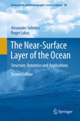
The Near-Surface Layer of the Ocean: Structure, Dynamics and Applications
Alexander Soloviev and Roger Lukas
- Updating the previous edition of the book due to remarkable results from synthetic aperture radar satellites, from satellites which measure sea surface salinity, and computational fluid dynamic models open new opportunities in understanding the processes in the near-surface layer of the ocean
- Monitoring short surface waves has significantly progressed due to passive acoustic methods
- Gives a comprehensive account of the structures and dynamics of the near-surface layer of the ocean
- Clarifies theoretical concepts that are developed from fundamental physics and thermodynamics
- Shows results of major air-sea interaction experiments (including those obtained with the participation of the authors), included in the analysis
- Includes an overview of the results for important oceanographic applications such as remote sensing, climate, hurricane physics, oil spills, marine biology, optics and acoustics
-

Coral Reefs of the Chagos Archipelago, Indian Ocean
Mebs Ateweberhan, Allen C. Chen, Alasdair Harris, Rachel Jones, Shashank Keshavmurthy, Carl Lundin, David Obura, Samuel J. Purkis, Peter Raines, Bernhard Riegl, Michael H. Schleyer, Anne L. S. Sheppard, Jerker Tamelander, John R. Turner, Shakil Visram, and Sung-Yin Yang
-

Atlas of Saudi Arabian Red Sea Marine Habitats
Andrew Bruckner, Gwilym Rowlands, Bernhard Riegl, Samuel J. Purkis, A Williams, and Philip Renaud
The Red Sea is a narrow, but relatively deep, oceanic trough that extends for over 1900 km, between 13º and 28º N latitude. It has a total surface area of roughly 438,000 km², with a width of approximately 180 km in the north, and 354 km at its widest point in the south. The Red Sea narrows to about 29 km in the Strait of Bab el Mandab, where it joins the Gulf of Aden and the Indian Ocean. The maximum depth is over 2200 m, with an average depth of 490 m. The Red Sea is shallowest at the southern end, with depths of only 130 m in the Strait of Bab el Mandab. It is the world’s northernmost tropical sea, with extensive shallow shelves that support complex coral reefs and associated ecosystems.
The Red Sea is part of the tropical Indo-Pacific Ocean, which encompasses the largest marine ecosystem on earth and also the most diverse. Much of the Saudi Arabian Red Sea coastline is characterized by coastal fringing reefs that are narrow, extending tens of meters from shore before plummeting to deep water. However, several regions in Saudi Arabia contain extensive seagrass beds, offshore reef habitats, mangroves, and algal flats. These areas support a wide range of reef morphologies, such as barrier reefs, patch reefs, ridge reefs, atolls, tower reefs, pinnacles, pillars, and spur and groove structures, as well as diverse coral communities growing on algalderived limestone structures (Sheppard et al. 1992).
Over a four year period, the Living Oceans Foundation has been involved in a massive scale marine habitat research project in the Red Sea. The results are now published in this first ever atlas of the Red Sea marine habitats of offshore coral reefs. It is available for download in both English and Arabic.
-

Coral Reef Remote Sensing: A Guide for Mapping, Monitoring and Management
James A. Goodman, Samuel J. Purkis, and Stuart R. Phinn
Remote sensing stands as the defining technology in our ability to monitor coral reefs, as well as their biophysical properties and associated processes, at regional to global scales. With overwhelming evidence that much of Earth’s reefs are in decline, our need for large-scale, repeatable assessments of reefs has never been so great. Fortunately, the last two decades have seen a rapid expansion in the ability for remote sensing to map and monitor the coral reef ecosystem, its overlying water column, and surrounding environment. Remote sensing is now a fundamental tool for the mapping, monitoring and management of coral reef ecosystems. Remote sensing offers repeatable, quantitative assessments of habitat and environmental characteristics over spatially extensive areas. As the multi-disciplinary field of coral reef remote sensing continues to mature, results demonstrate that the techniques and capabilities continue to improve. New developments allow reef assessments and mapping to be performed with higher accuracy, across greater spatial areas, and with greater temporal frequency. The increased level of information that remote sensing now makes available also allows more complex scientific questions to be addressed. As defined for this book, remote sensing includes the vast array of geospatial data collected from land, water, ship, airborne and satellite platforms. The book is organized by technology, including: visible and infrared sensing using photographic, multispectral and hyperspectral instruments; active sensing using light detection and ranging (LiDAR); acoustic sensing using ship, autonomous underwater vehicle (AUV) and in-water platforms; and thermal and radar instruments.
Emphasis and Audience This book serves multiple roles. It offers an overview of the current state-of-the-art technologies for reef mapping, provides detailed technical information for coral reef remote sensing specialists, imparts insight on the scientific questions that can be tackled using this technology, and also includes a foundation for those new to reef remote sensing. The individual sections of the book include introductory overviews of four main types of remotely sensed data used to study coral reefs, followed by specific examples demonstrating practical applications of the different technologies being discussed. Guidelines for selecting the most appropriate sensor for particular applications are provided, including an overview of how to utilize remote sensing data as an effective tool in science and management. The text is richly illustrated with examples of each sensing technology applied to a range of scientific, monitoring and management questions in reefs around the world. As such, the book is broadly accessible to a general audience, as well as students, managers, remote sensing specialists and anyone else working with coral reef ecosystems.
-

Acoustic Methods Overview
Bernhard Riegl and Humberto Guarin
[Chapter Abstract] Acoustic methods are widely used for the production of physical, environmental and biological data required for the responsible management of marine resources, such as coral reefs. Here, we review the basic physical properties of sound in water that can be harnessed for active or passive acoustic remote sensing systems. Sound, by assessing the return characteristics of emitted sound waves, can be used to derive information on seafloor topography via depth (obtained by measuring travel time), on seafloor makeup (obtained by measuring backscatter intensity), or on water column characteristics (obtained by measuring Doppler shifts). Sound is also used to track organisms such as fish or even to create images by harnessing natural sound sources to “illuminate” objects like fish. Acoustic methods have a place in the toolbox of every coral reef manager.
-

Environmental Setting and Temporal Trends in Southeastern Gulf Coral Communities
Kristi Foster, Greg Foster, Ashraf S. Al-Cibahy, Suaad Al-Harth, Sam J. Purkis, and Bernhard M. Riegl
[Chapter Abstract] The majority of coral reefs are found in tropical environments between 25°N and 25°S, where typical seawater temperatures and salinities are between 18°C and 31°C and 34–37 ppt, (Kleypas et al. 1999; Veron 1986). The marine environment of the southeastern Arabian Gulf is singularly harsh; the coral communities in this high-latitude region (i.e. between 24°09′N and 25°40′N) are exposed to natural conditions that exceed threshold limits of corals elsewhere in the world, with temperature ranges between 14°C and 36°C (Kinzie III 1973; Shinn 1976) and salinities above 40 ppt. Less than one-third of the scleractinian species that are found in the neighboring Gulf of Oman have adapted to survive in the Arabian Gulf (e.g. Acropora spp., Porites spp., faviids and siderastreids) (Riegl 1999; Coles 2003; Rezai et al. 2004; Claereboudt 2006). Other benthic taxa that are common in the Gulf of Oman but are absent from the Arabian Gulf include the coral genera Montipora, Pocillopora, and Goniopora spp., fungiids, oculinids, alcyonaceans, and massive sponges. The adaptations of some taxa to extremes of temperature and salinity and the exclusion of other taxa are of interest to scientists studying the impacts of global climate change on coral reefs and other marine organisms.
-

Analogs for Carbonate Deposition in Early Rift Setting
Paul Mitch Harris, James Ellis, and Samuel J. Purkis
Driven by requests to provide carbonate analogs for subsurface hydrocarbon exploration in rift settings, we have identified and described select examples, summarized them from a carbonate perspective, and assembled them into a GIS database. The analogs show a spectrum of sizes, shapes and styles of deposition for lacustrine and marginal marine settings, wherein the types of carbonates inferred from seismic and cores (emphasis on microbialites, tufas, and travertines) can be illustrated.
-

Laboratory Exercises in Biology
Edward O. Keith, Charles Messing, Emily F. Schmitt Lavin, and Joshua Stephen Feingold
Third edition
-

Geomorphology and Reef Building in the SE Gulf
Sam J. Purkis
[Chapter Abstract] The Gulf, a subtropical epicontinental sea, is home to the northernmost coral reefs on the western boundary of the Indo-Pacific. The basin has an area of 250,000 sq. km and is shallow and semi-restricted, which combined with its high-latitude and the presence of mountainous plateaus and deserts nearby, make the Gulf’s climate the most extreme endured by reef-building corals anywhere in the world (Riegl et al. 2011, Chaps. 2, 7, and 9). Despite the hostile conditions, the Gulf is home to about 40 species of scleractinian and 31 species of alcyonacean corals, representing an impoverished but typical segment of that of the Indo-Pacific. The Gulf is unique in many respects, most notably in terms of its water chemistry, inclement climate (hot summers but also cold winters), and the hardiness of the corals that inhabit it. These factors conspire to prevent the development of spectacular reef edifices, like those that exist in the adjacent Red Sea, but nonetheless the expression of coral growth is as varied and interesting as the prevailing climate. The Gulf marks the separation between the stable Arabian foreland, atop which the U.A.E. sits, and the unstable Iranian fold belt. This positioning generates a specific geological set-up which conveys primary control on the geomorphology of the basin and in turn, the opportunities for reef development. Of particular note is the influence that salt tectonics play in the creation of offshore banks and islands, all of which support coral communities. Secondary and more recent modification has been exerted by the flooding of the Gulf during the last transgression, with the majority of the basin having lain sub-aerially exposed for considerable periods in the last 100,000 years. This complex and rich genesis brings the Gulf to a crossroads in the present day; we witness an unprecedented level of coastal development and modification fueled by rising economic prosperity on the back of vast hydrocarbon discoveries. Many areas of spectacular coral growth have been lost to construction, but some remain, for now. This chapter will detail the status of these ecosystems and the factors that have shaped them through time.
-
 Coral Fauna of the Gulf by Bernhard Riegl, Francesca Benzoni, Kaveh Samimi-Namin, and Charles Sheppard")
The Hermatypic Scleractinian (Hard) Coral Fauna of the Gulf
Bernhard Riegl, Francesca Benzoni, Kaveh Samimi-Namin, and Charles Sheppard
[Chapter Abstract] The harsh climate of the Gulf puts severe constraints on coral survival and, therewith, on biodiversity by restricting the number of coral species that can survive in the harsh conditions. Despite this and despite being at the western high-latitude edge of Indo-Pacific reef coral distribution, the Gulf’s coral fauna is surprisingly rich. Within the region, the richest Gulf coral fauna has been recorded from Saudi Arabia, around the islands of Jana and Karan (50 species, Basson et al. 1977). Fadlallah et al. (1993) subsequently recorded 23 and 19 species in specific sample sites on these two islands and suggested that species richness may actually be lower than suggested by Basson et al. (1977). This is also supported by data in Vogt (1996). The UAE presently has the second-richest documented coral fauna, with 34 scleractinian species (Riegl 1999). More comprehensive studies in other areas and the region would likely reveal a quite homogeneous fauna with little diversity gradient across the Gulf proper. The Iranian coral fauna is rich due to water circulation pattern and better environmental conditions in the northern Gulf. Due to counter clock wise pattern of the water circulation in the Gulf, the northern part and the Iranian coastline has lower temperature, lower salinity, better aragonite saturation, besides also greater depth (see Chap. 2). This results in increasing species richness towards the Straits of Hormuz. In general, coral diversity decreases from east to west and from north to south. This has been seen in octocorals (Samimi-Namin and van Ofwegen 2009) and the same trend exist for hard corals (Samimi-Namin, unpublished data). It is still unclear where the main species boundaries are located and therefore further studies are necessary to fully reveal coral diversity in the Gulf.
-
 and Their Effects on Gulf Coral Populations and Communities by Bernhard Riegl, Andrew W. Bruckner, Kaveh Samimi-Namin, and Sam J. Purkis")
Diseases, Harmful Algae Blooms (HABs) and Their Effects on Gulf Coral Populations and Communities
Bernhard Riegl, Andrew W. Bruckner, Kaveh Samimi-Namin, and Sam J. Purkis
[Chapter Abstract] Corals in the Gulf exist in a harsh environment, which only allows a small subset of the typical Indo-Pacific fauna and flora to persist and/or form viable populations (Sheppard and Sheppard 1991; Sheppard et al. 1992; Samimi-Namin and van Ofwegen 2009; Chaps. 11 and 12). Environmental factors have been identified as the major killers of corals and these factors regulate population dynamics and coral reef community structure (Chaps. 2, 5, 10 and 16). Among these, extreme temperature variability, salinity variability and turbidity (as a result of coastal construction, Chap. 16) have been isolated as prime killers.
-

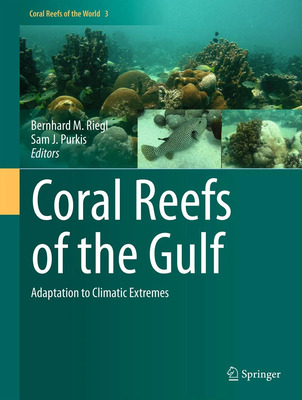
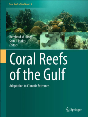
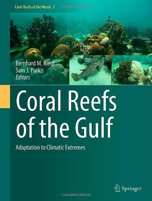
Coral Reefs of the Gulf: Adaptation to Climatic Extremes
Bernhard M. Riegl and Sam J. Purkis
First complete compilation of biology and geology information for all Gulf reefs
Detailed case studies of extremely heat- and cold-adapted reefs
Richly illustrated with more than 200 color figures -

Environmental Constraints for Reef Building in the Gulf
Bernhard M. Riegl and Sam J. Purkis
[Chapter Abstract] The Gulf is a peripheral basin of the Indian Ocean, at roughly 23°50′–29°52′ degrees northern latitude. It harbors extensive coral growth in one of the highest latitude locations in the world (Table 2.1). Due to its high-latitude position, its shallow nature, and its position within the great desert belt, the Gulf and its corals are exposed to extremes in temperature, salinity and other physical factors (Kinsman 1964a, b; Sheppard et al. 1992). But despite a seemingly hostile climate, corals endure and have been shown to exhibit remarkable resilience and vitality even if faced by some of the most extreme environmental conditions corals have to endure anywhere. This chapter will outline the most important physical constraints on reef building.
-

Coral Bleaching and Mortality Thresholds in the SE Gulf: Highest in the World
Bernhard M. Riegl, Sam J. Purkis, Ashraf S. Al-Cibahy, Suaad Al-Harthi, Edwin Grandcourt, Khalifa Al-Sulaiti, James Baldwin, and Alaa M. Abdel-Moati
[Chapter Abstract] Bleaching is a stress reaction in corals, during which the symbiosis between corals and the algae (zooxanthellae) living in the coral cells breaks down. As a result, zooxanthellae are expelled, and the coral appears pale or even white (Fig. 6.1; Baker et al. 2008). The link between environmental variables and coral bleaching has been well-established in a variety of studies and synthesized in several places (Phinney et al. 2006; Baker et al. 2008; van Oppen and Lough 2009). Large-scale and region-wide bleaching events, such as occur in the Gulf, have been clearly linked to unusually high temperatures and the accumulation of heat stress in corals. Other drivers, such as UV and water acidity can have compounding effects (Baker et al. 2008) and bleaching can also be caused by these factors alone, or other local drivers such as unusually cold temperatures (Saxby et al. 2003; Lajeunesse et al. 2007). However, it is heat stress that has been demonstrated as the most reliable predictor and defined time-integrated bleaching thresholds exist for various regions of the Indo-Pacific and the Caribbean (Berkelmans 2002a, b; Manzello et al. 2007; Berkelmans 2009).
-

Dynamics of Gulf Coral Communities: Observations and Models from the World’s Hottest Coral Sea
Bernhard Riegl and Sam J. Purkis
[Chapter Abstract] Coral reefs are adapted to a relatively narrow band of environmental optima and the harsh Gulf environment tests the physiological and ecological limits of reef corals. The environmental variability (minimal and maximal annual temperatures, salinity extremes, etc.; Chap. 2; Sheppard et al. 1992, 2010) are outside the range of typical tropical reefs. Regular summer temperatures are several degrees above the bleaching and mortality thresholds of some regions in the Great Barrier Reef and the Caribbean (Baker et al. 2008; Chap. 6). Yet, corals thrive in the Gulf. However, they have recently been exposed to severe temperature anomalies at a recurrence faster than in any other coral reef region (Riegl 2002, 2003; Sheppard and Loughland 2002; Riegl and Purkis 2009; Sheppard et al. 2010) and it appears that hot-anomalies are increasing in severity and frequency (Nasrallah et al. 2004). Thus, corals in the Gulf already exist in a thermal environment that is equal to, or even worse than, what is predicted (IPCC 2007) as occurring throughout the tropical oceans by 2099 and recognized as likely causing problems for coral reef persistence. Clearly, important lessons can be learned from Gulf corals about environmental extremes that corals can survive and, given the high frequency of disturbances, maybe even lessons in adaptability. Since the world is getting warmer and extremes are becoming more pronounced, the study of such extreme reef systems gains increased relevance.
-

Coral Reefs of the Gulf: Adaptation to Climatic Extremes in the World’s Hottest Sea
Bernhard Riegl and Samuel J. Purkis
This book treats coral reefs in the water body enclosed between Iran and the Arabian peninsula that in this book we refer to as “The Gulf”. The area is variably also known as the Persian or Arabian Gulf, or as the ROPME Inner Sea Area. The Gulf has a long research history and a compilation of present knowledge about its reefs is timely. In 16 chapters, this book guides the reader through environmental and geological determinants of reefbuilding, through the dynamics of reef corals and reef fishes, to the taxonomy of key reef organisms. Also the importance of artificial structures as novel reef substrates is discussed.

